

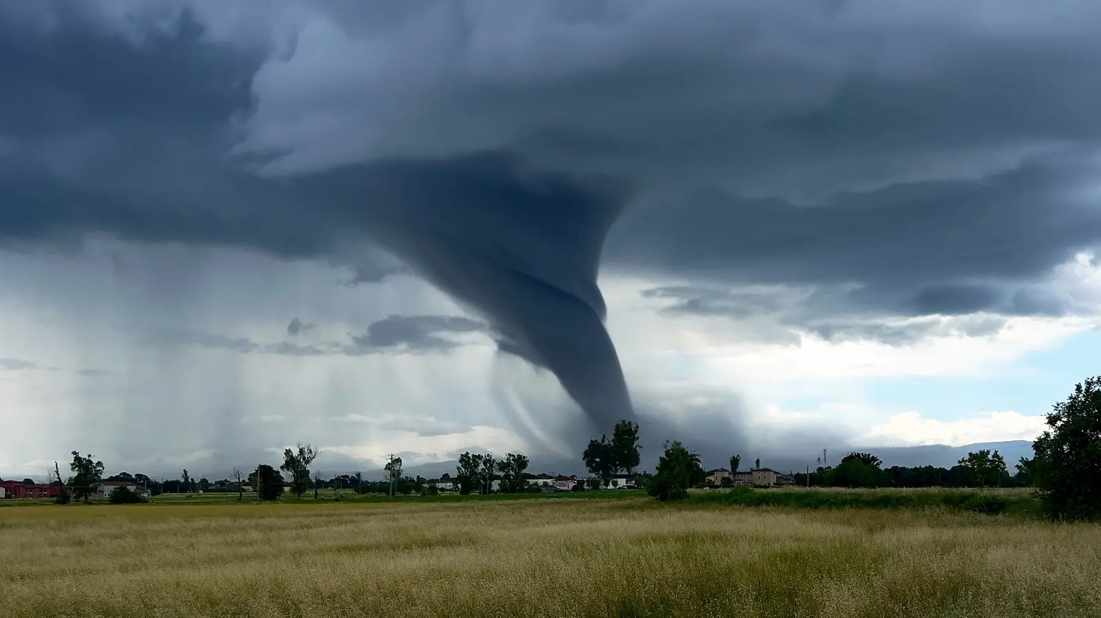
Both hurricanes and tornadoes produce some of the most violent winds on Earth, but they are very different types of storms. A hurricane is a tropical cyclone that forms over warm ocean water, drawing energy from heat and moisture. It can stretch across hundreds of miles and last for many days, moving slowly across the ocean before making landfall. A tornado, by contrast, is a narrow column of violently rotating air that descends from a severe thunderstorm. It usually lasts only minutes and covers a much smaller area, yet it can hold higher wind speeds than any hurricane ever measured. That may seem surprising because hurricanes cause such widespread destruction, but the compact nature of a tornado allows its winds to accelerate to extraordinary levels in a very short time.
Why Hurricanes and Tornadoes Are So Different
Hurricanes begin as clusters of thunderstorms over tropical oceans. When sea surface temperatures are warm, the air above them heats up and rises, creating an area of low pressure. Air from surrounding regions rushes in, and the rotation of the Earth causes that air to spin. As the system strengthens, it organizes into a massive spiral with a calm center known as the eye. Around the eye sits the eyewall, where the most intense winds and rainfall occur. A fully developed hurricane can span more than 300 miles, and its winds can remain dangerous for days, especially if it stays over warm water. Even after moving inland, a hurricane can produce heavy rain, storm surge, and tornadoes of its own.
Tornadoes, on the other hand, are not tied to warm oceans. Most form along the boundary between warm, moist air and cooler, drier air during severe thunderstorms. Strong wind shear, which is a change in wind speed or direction with height, makes the air near the ground rotate. When that rotation tightens and is pulled upward by the storm's updraft, a mesocyclone can form. If the rotation continues to intensify, the storm may produce a tornado. These twisters are usually only a few dozen to a few hundred yards wide, and their paths are often short. But the concentration of energy in such a small area is what allows them to reach extreme wind speeds.
Which Event Has Faster Wind Speeds?
For decades, scientists have compared maximum wind speeds in hurricanes and tornadoes. The measured record for the fastest wind on Earth was set on May 3, 1999, when a research radar parked near a tornado outside Oklahoma City clocked air moving at 301 miles per hour just above the ground. That instrument was a Doppler radar mounted on a truck, positioned directly in the tornado's path during a major outbreak in Tornado Alley. The reading remains one of the most famous measurements in severe weather science.
Hurricanes have never come close to that number in the Atlantic. The strongest Atlantic hurricanes top out at roughly 190 miles per hour of sustained wind. Sustained wind is defined as the average speed the storm holds over a full minute. That means a hurricane may produce gusts that are somewhat higher, but its sustained winds remain well below the peak measured in a violent tornado. So if the question is simply about the fastest wind speed on record, tornadoes win. But that is not the same as saying tornadoes are always more dangerous.
How Doppler Radar Measures Wind
The most common tool used to measure storm winds is Doppler radar. A Doppler radar dish sends short pulses of radio waves toward a storm. Those waves bounce off raindrops, hail, and airborne debris and return to the dish. Because the targets are moving, the frequency of the returned signal is slightly different from the original pulse. This is known as the Doppler effect, the same principle used by police radar to measure the speed of a car. The radar computer analyzes the frequency shift to determine how fast the air is moving toward or away from the dish. That gives meteorologists a way to estimate wind speeds from a safe distance.
Weather radar can scan large areas and identify rotation inside a thunderstorm, which is helpful for issuing tornado warnings. But a distant radar beam cannot always see the most intense winds near the ground because the beam spreads out with distance and may pass above the tornado. This is why mobile radar units are used. These portable Doppler systems are often mounted on the flatbed of a truck, allowing scientists to set up close to a developing tornado. That is exactly how the 301 mph reading was made. The research team had to be in the right place at the right time, and even then, a direct hit is largely a matter of luck.
Planes and Dropsondes Catch Hurricane Winds
Doppler radar is not the only instrument used to measure storm winds. For hurricanes, forecasters also rely on weather stations, satellites, and specially equipped aircraft. A standard weather station often uses an anemometer, the spinning cup device that measures wind speed by logging averages over a full minute. These instruments work well when a storm passes directly over them, but hurricanes are large and can be dangerous for ground equipment. To get more accurate data, forecasters turn to reconnaissance aircraft.
The National Oceanic and Atmospheric Administration operates Hurricane Hunter planes that fly straight through a hurricane's eyewall. These flights are often bumpy and risky, but they provide invaluable information. The crew releases tube-shaped devices called dropsondes, which are packed with sensors. As a dropsonde falls toward the water, it radios back temperature, pressure, humidity, and wind data at many different heights. This gives forecasters a vertical profile of the storm, which is far more useful than a single surface reading. In 2025, for example, a dropsonde released from a Hurricane Hunter recorded a 252 mph gust while investigating Hurricane Melissa before it reached Jamaica.
Measuring Tornadoes Is a Game of Chance
Tornadoes are much harder to measure than hurricanes because of their small size and short lifespan. A tornado may touch down for only a few minutes, and its path may be less than a mile long. The odds of a weather station with an anemometer being exactly in its path are very low. This is why scientists who want to measure tornado wind speeds must bring the instruments to the storm. Mobile radar trucks are one option, but they cannot always be in the right position. Another approach is to put a Doppler radar on an airplane and fly near the tornado.
The first direct tornado measurements from the air came from a project at the NOAA Severe Storms Laboratory. Researchers took a P-3 Orion, a long-serving U.S. surveillance aircraft, and fitted it with a Doppler radar. Flying close to a tornado allowed the radar to sample the circulation from a shorter distance, providing a much clearer picture of the wind field. Repeated flights have helped scientists understand how tornadoes evolve and how the strongest winds relate to damage on the ground. Still, every tornado is different, and getting instruments close enough remains difficult.
Different Storms, Different Rating Scales
The methods used to measure these storms also shape the way they are rated. Hurricanes are classified using the Saffir-Simpson hurricane wind scale, which ranks storms from 1 to 5 based only on maximum sustained wind speed. A Category 1 hurricane has winds of 74 to 95 mph, while a Category 5 has winds of 157 mph or higher. The rating is derived from direct measurements such as dropsondes, aircraft flight-level winds, and surface observations. It gives the public a quick sense of how intense a hurricane is, although it does not account for storm surge, rainfall, or tornadoes that may accompany the storm.
Tornadoes use a different system called the Enhanced Fujita scale. It has been in use since 2007 and is based not on direct wind measurements but on damage assessments. After a tornado passes, survey crews from the National Weather Service walk through the affected area and inspect the wreckage. They compare what they find to a list of 28 damage indicators, which includes homes, mobile homes, schools, trees, and transmission towers. Each indicator has specific wind speeds tied to different degrees of damage. From there, surveyors estimate the strongest three-second gust that would have caused the observed destruction. That estimate determines the tornado's rating, from EF0 for minor damage to EF5 for incredible damage.
This means hurricane categories and tornado ratings are not directly comparable. A hurricane's rating is based on measured sustained wind, while a tornado's rating is an estimate based on damage. The 1999 tornado near Oklahoma City was eventually rated EF5, but its 301 mph measurement came from a research radar that was not part of the official rating process. In contrast, the 252 mph gust in Hurricane Melissa was a single gust, not a sustained wind, so it did not change the hurricane's category either. Both measurements are important reminders that the most powerful storms on Earth are still difficult to observe and full of surprises.
Source: SlashGear News